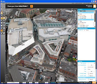
I don't have a clue yet as to what this precisely is, what it costs, on which platforms it runs or how it can be used alongside your regular tools, but I was amazed by the demo movie. Seems like a combination of Google Earth with detailed 3D models, with GIS and other information (metadata), possibly linked to SketchUp.
It seems to be marketed as a service offering, currently focused on UK cities. But it also seems to be a software tool. Not sure if and when it will be available.
Realtime 3D urban models, realtime shadows, visualization ...
Interesting. Please take a look.

It seems to be marketed as a service offering, currently focused on UK cities. But it also seems to be a software tool. Not sure if and when it will be available.
Realtime 3D urban models, realtime shadows, visualization ...
Interesting. Please take a look.

Thanks for posting about Skape. Skape has been developed by Infoterra to allow architects to import their building design into a prebuilt fully rendered 3D environment. They can then perform shadow casting, view froms, generate videos, JPEGs and 3D PDFs to help conceptualise their design. If users prefer they can export any of the data and bring it into Sketchup or CAD packages.
ReplyDeletethe software has been developed inhouse as we found that tools like Google couldnt load the 5cm texture sizes we are serving. Skape is now live and available to use.
Thanks Paul